|
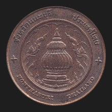
Nonthaburi (นนทบุรี)
Thai.
Name of a
jangwat (map) and its provincial capital, in Central Thailand. It is a
suburb of
Bangkok, only 20 kms to its West and bordering it. The
earliest evidence of people inhabiting the area goes back to the
14th century
Wat
Prang
Luang, a temple that
U-Thong, the later
King
Ramathibodi I, had built in the
amphur
Bang Yai, as a community centre for his people, who had fled
Meuang U-Thong from an epidemic,
sometime before the formation of
Ayutthaya as the Siamese
capital. This
community later dispersed to other places in the area, the most
important being a
Chao Phraya riverside village named Ban Talaat Khwan (บ้านตลาดขวัญ). In 1548,
King
Chakraphandi ordered a canal dug across the area, starting from the
North of Wat Chalo (วัดชลอ) to the vicinity of Wat Moon Lek (วัดมูลเหล็ก),
which today is known as Wat Suwan Khiri (วัดสุวรรณคีรี) in the
khet Bangkok Noi (บางกอกน้อย),
creating a shortcut of the flow of the Chao Phraya River, delivering
more water for agriculture and allowing a quicker way to travel. In the same year, the Burmese troops of king
Tabinshwehti attacked Ayutthaya and many people had fled the cities. In 1549, after the
Burmese had killed queen
Suriyothai
and then retreated, King
Chakraphandi declared Ban Talaat
Khwan a city, renaming it Meuang Talaat
Khwan, in an attempt to lure back the population, so that if war would come again, he could more easily enlist his subjects. Besides
this, having the status a city gave the place the potential to become a harbour
city, as well as a southern outpost of Ayutthaya. In 1636,
King Prasat
Thong (1629-1656)
ordered another
canal dug, starting South of Wat Thai Meuang (วัดท้ายเมือง) to Wat
Khamao (วัดเขมา). By cutting of a bend of the river, the flow of the Chao Phraya
was permanently changed, creating a new riverbed which today still
flows in front of the now former City Hall (fig.)
and allowing a quicker way to the capital Ayutthaya. Since the
shorter riverway was also giving potential enemies easier access to
the capital, King
Narai in 1665 moved the town of Meuang Talaat
Khwan to a new location near the newly dug canal and had it walled
and had two fortresses built, i.e. Pom Kaew (ป้อมแก้ว) and Pom
Thabthim (ป้อมทับทิม), the first
one near the present-day Wat Pahk Nahm (วัดปากน้ำ), literally the
‘Temple at the Mouth of the River’, the latter at today's Wat
Chaloem Phra Kiat (วัดเฉลิมพระเกียรติ),
though today both the fortified wall and the fortresses have been
demolished. In 1721, King
Thai Sra (1708-1733)
had another canal dug and as a result created the island
Koh Kret.
In 1764,
the Burmese King Hsinbyushin, ordered his general to march his troops on Ayutthaya
from the South, levelling the path by first capturing
Thonburi
and Nonthaburi. To fight these two cities, the
advancing troops split up, sending one detachment to area of Wat
Khamao, the other to Thonburi. In their advance, the latter were
confronted with an English commercial vessel that was anchored near
Thonburi and had volunteered to help fight the Burmese invaders with
their heavy artillery, but they couldn't resist the aggressors and
eventually had to flee. From there, the Burmese went northwards,
arriving in Ayutthaya in 1766 and sacking the capital in 1767.
During the occupation of their city, the population of Nonthaburi
fled land inward, away from the river and canals, toward Bang Yai
and Bang Kruwey. After the liberation by General
Taksin, who drove the Burmese out and became the new
king, the situation turned back to normal and the citizens returned,
now joined by people and refugees from other places, including the
Mon, who were granted permanent residence. From 1943 to 1946,
the province was temporarily incorporated into Bangkok. Nonthaburi
is known for its
pottery production
(fig.) and its main attractions today
are the
Mon pottery island of
Koh Kret
(map
-
fig.), with its
leaning Mutao
Pagoda (map
-
fig.);
the Old City Hall on the Chao Phraya River, which today is home to the Nonthaburi Museum (map
-
fig.);
the city's Clock
Tower (map
-
fig.); and the Thai-Chinese temple
Wat
Boromaracha Kanchana Phisek Anuson
in Bang Bua Thong, the largest
Mahayana Buddhist temple in the Kingdom (map
-
fig.).
Nonthaburi province has six
amphur. See
also
Nonthaburi data file,
and
THEMATIC STREET LIGHTS
(1),
(2),
(3)
and
(4).
回


|

