|
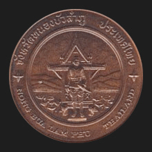
Nong Bua Lamphu (หนองบัวลำภู)
Thai.
Provincial capital of a
jangwat (map) of the same name, in
Northeast Thailand, at 577 kms from
Bangkok. The name derives from
the words nong (หนอง), bua (บัว), lum (ลุ่ม) and phu (ภู), a reference to the region's
geography, being a marshland (nong) with
lotuses (bua), and
with both low plains (lum) and mountains (phu). About 900 years ago
this region was a stronghold of
Krung Sri Satana Kanahut. During
the existence of the
Lan Chang
kingdom it was traditionally ruled by the realm's crown princes. In
1574, the Thai King
Somdet
Phra
Maha
Dhammaracha
(1569-1590)
and his son, prince
Naresuan, led a military expedition to invade Lan Chang,
herewith backing
the King of Hongsawadi in his fight against the
city of Krung Sri Satana Kanahut. On the way, the
young prince rested his troops in the area of Nong Bua Reservoir to
prepare for the invasion, but fell ill from small pox and had to
return to
Ayutthaya. After its fall to the
Burmese in 1569, the Siamese capital had become virtually
defenseless and was constantly prone to the repetitive raids of the
Khmer. Due to this, the Burmese had allowed
their Siamese vassals to improve their army and increase its
manpower, and thus, before returning, the prince gathered new troops
in the area. Later, however, he would use these troops to fight the
Pagan Burmese Kingdom of Toungoo. In 1759, a fortified
camp with stone walls, complete with a watchtower, was built in the
area of today's Thao Toh waterfall, by Phra Wo (พระวอ) and Phra Ta (พระตา),
two legendary brothers, who served as high-ranking officials for
Phra Chao Siri Boonsaan (สิริบุญสาร)
of
Vientiane.
The place was then known as
Nakhon Kheuan Khan Kaab Kaew Bua
Ban (นครเขื่อนขันธ์กาบแก้วบัวบาน). In 1767, exploiting the moment
when there were not too many soldiers present, the two brothers
revolted against Siri Boonsaan, took some of his family members
hostage and fled with their supporters to the fortified camp, which
then became known as the Phra Wo-Phra Ta Camp. Shortly thereafter,
Laotian troops raided the camp, but it took them more than 3 years
to capture it, in which they only succeeded after receiving support
form extra troops brought in from
Chiang Mai.
After this, the area remained uninhabited for many years. In 1827,
Chao Anou of Vientiane designated a governor to the area, thus
breaking with the tradition of royal rulers. In 1890, many local
municipalities were reordered into one administrative district known
as Meuang Lao Fai Neua (เมืองลาวฝ่ายเหนือ) or
‘Lao Cities of the
North’. Consequently, the then governor of
Nong Kai
ordered Nakhon Kheuan Khan Kaab Kaew Bua Ban to
be resettled, appointed a new ruler and changed the city's name into
Meuang Kamutasai (เมืองกมุทธาสัย). In 1900, during the reign of
King
Rama V, the name of the northern district was changed
from
Monthon
Fai Neua to Monthon
Udon and with this reorganization,
the name of Meuang Kamutasai was changed to Meuang Nong Bua Lamphu.
In 1907 the city became a district of
Udonthani.
Though, Udonthani was a large province with a population of over a
million and in 1993, in accordance with the federal government's
decentralization policy, the province was separated into two
provinces, and the districts of Sri Bun Reuang (ศรีบุญเรือง)
and Suwanna Kuh Hah (สุวรรณคูหา)
merged to form the new province of Nong Bua Lamphu, which today has
a total of six
amphur.
See also
Nong Bua Lamphu data file. 回


|

