|
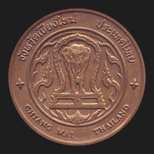
Chiang Mai (เชียงใหม่)
Thai. ‘New City’. The city of Chiang Mai is also the capital of the
province
of the same name (map)
and is situated in North Thailand (fig.)
along the banks of the
Ping River (fig.),
at about 745 km North of
Bangkok and on an altitude of
roughly 310 meters above sea level. The city
now has a population of approximately 168,000, whilst the province
has around
1,650,00
inhabitants. It was
formerly named Nopburi Sri Nakhon Phing. The city was founded in
1296 AD by king
Mengrai as the new capital of the
Lan Na
kingdom. He consolidated his power in the northern regions by making
a pact with the rulers of two neighboring kingdoms (fig.),
i.e. King
Ramkamhaeng
of
Sukhothai and king
Ngam Meuang
of
Phayao. In 1558 the city of
fell to the Burmese forces of king
Bayinnaung when
Phra Chao Burengnong captured the city from Phra Chao
Mekuthi in a three-day battle. It was made
a vassal of Burma, required to pay annual tributes of
silver and gold trees.
Phra Chao
Mekuthi tried to get rid of the Burmese control and was
consequently deposed in 1564.
For many
years Chiang Mai and the North had been struggling under Burmese
oppressive rule, especially when the area came to be used as the
major forward base for Burmese military operations against
Ayutthaya
and
Thonburi,
and its population was frequently called upon to provide manpower.
In 1774, Lan Na forces under the command of Prince Chaban, ruler of
Chiang Mai and
Chao Kawila, then ruler of Lampang and a descendant of the house of
Thipchakratiwong,
were sent by the Burmese to help defend against an invading Siamese
army from Thonburi, but instead went over to the Siamese side and
joined forces with the troops of King
Taksin in recapturing the
main northern cities and driving out the Burmese occupiers. By the
time Chiang Mai was recaptured the city was however almost
completely abandoned, due to the foreign suppression and the fact
that the Burmese used it as a base to wage their military campaigns.
Chao Kawila
consequently repopulated the city with local people as well as with
Shan
and other ethnic groups, formally re-establishing the city in 1796.
Being allied to the Siamese, king
Rama V in 1892 took over the administration of Chiang Mai
which in 1932 became a province of
Siam. The province today covers an
area of 20,107 kmē and has 22
amphur, two
king amphur, 204
tambon
and 1,915 villages. In size of area is the
second-biggest province of Thailand, but with regards to population
it ranks only sixth. Its
places of interest include Thailand's highest mountain
Doi Inthanon (map
-
fig.)
in Doi Inthanon National Park (map
-
fig.),
Wachirathan Waterfall (map
-
fig.),
the famous Buddhist temple
Wat Doi Suthep (map
-
fig.),
Wat Phrathat Sri Chom Thong Wora Wihaan
(map
-
fig.),
Uthayaan Phuttasathaan Suttichit (map
-
fig.), Oub Luang National Park (map
-
fig.), the giant
pandas Chuang-Chuang and Lin-Hui (map
-
fig.),
Mae Fahng
National Park (map
-
fig.),
Chiang Dao Cave (map
-
fig.),
Doi Suthep-Pui
National Park (map
-
fig.),
Huay Nahm Dang National Park
(map
-
fig.),
the Northern Telecoms of Thailand Museum (map
-
fig.),
the
Inthakhin Chiang Mai
(fig.)
or
City Pillar
(map
-
fig.),
Tha Phae
Gate (map
-
fig.),
Chiang Mai House of Photography (map
-
fig.), and
Lanna
Folklife Museum (map
-
fig.),
shopping areas, such as a
night bazaar, Maya Lifestyle Shopping Center (vdo),
Central Airport, Central Festival, etc. Popular activities would include mountain hiking. The
city also maintains a tradition of local handicraft manufacturing,
such as the making of umbrellas, woodcarvings and furniture, silk
weaving, silver and bronze artifacts, etc. The province is home to
several hill tribe peoples and is bordered by
Burma's
Shan State in the North,
Chiang Rai in the Northeast,
Lamphun and
Lampang in the East,
Tak in the South and
Mae Hong Son in the West. Its main
waterways are the Ping, Fang, Taeng and Kuang rivers. The occupation
of the Chiang Mai people includes trading and business,
rice
farming, fruit and vegetable cultivation, fresh water fishing and
gardening. The province has many
lamyai
trees. See also
Chiang Mai data file
and
MAP.
回


|

