|
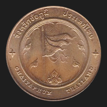
Chaiyaphum (ชัยภูมิ)
Thai. ‘Field of victory’ or ‘victorious land’. The name of a
province (map)
and its capital, in
Isaan. The city has around
25,000 inhabitants and is located at 342 kms Northeast of
Bangkok. The history of this city dates back to the 12th
century AD,
during the
Angkorian period of the
Khmer Empire,
when it was a small town on the way from
Angkor
to
Prasat Meuang Singh (fig.)
in present-day
Kanchanaburi
and of which
Prang Ku (fig.)
is today a remainder. In 1817 a group of Laotians from
Vientiane, led by Nai Lae, settled
in the area which they called Ban Luang. With the 1819 appointment
of his son Chao Yo as the ruler of
Champasak,
the power of the Laotian vassal king Chao
Anuvong of Vientiane greatly expanded, as did his ambitions and in
1827 he declared war on
Siam.
Nai Lae, the local Laotian ruler of Ban Luang, changed allegiance
and supported the Siamese troops. The Laotian troops were defeated,
but before that Nai Lae was killed on the battlefield. He was made a
local hero and was renamed Phraya Phakdi Chumpon. His monument today
stands in front of the Chaiyaphum City Hall. Geographically the
province is cut into two from North to South by the
Phetchabun mountain range, with the East of the province
belonging to the
Korat Plateau. Chaiyaphum province has five national
parks, the Taht Thohn National Park with several scenic waterfalls
and dry dipterocarp forests, the Saithong
National Park with its waterfall of the same
name and
Siam Tulip
fields, the Pah Hin Ngahm National Park
with its rock forest, bizarrely shaped rock formations, Phu Laenkha
National Park with its forested hills, and
Nahm Nahw National Park which territory is shared with Phetchabun
province. The name Chaiyaphum refers to the natural richness
and fertility of the soil. The province neighbours the provinces of
Khon Kaen,
Nakhon Ratchasima,
Lopburi and
Phetchabun,
and has 15
amphur
and one
king amphur, 124
tambon and 1,393
mu ban.
See also
Chaiyaphum data file.
回


|

