|
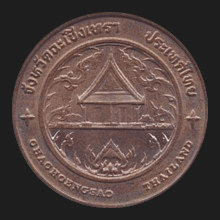
Chachengsao (ฉะเชิงเทรา)
Name of a province as well as the
capital city of this province (map)
in East Thailand, 82 kms to the East of
Bangkok, situated on the banks of the
Bang Pakong
River,
which divides the city in two. The name of the city which developed
around the river and its many canals is said to be a
Khmer word
meaning ‘deep canal’. The city has an old history, dating back to
the reign of King
Somdet
Phra
Borom
Trailohkanat (1448-1488
AD) in the
Ayutthaya
Period. Most of the people have settled by the Bang Pakong River
which is used extensively for farming
rice.
The main attraction is the
Sothon Wararam Worawihaan temple (fig.)
with the
Sothon Buddha image, one of the most sacred images in the
country and associated with the notorious
Luang Po Sothon, a
Phra saksit. This monk predicted the exact time of his
own death, to which thousands of spectators flocked to the temple to
watch him die, seated in the
dhyani meditation pose. The city (fig.) is also called
Paet Riw, a name that comes from a story which relates
that the city's river (fig.) once teemed with giant snake-head fish that
needed up to eight cuts (paet riw -
fig.) on each side, to make it into
sun-dried fish. The region is known for a particular kind of
mango, the
mamuang raed. The province has ten
amphur and one
king amphur, that are divided into 93
tambon and 859
mu ban.
Also transcribed Chachoengsao. See also
Chachengsao data file
and
MAP.
回


|

