|
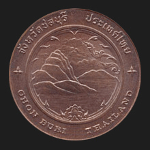
Chonburi (ชลบุรี)
Thai-Sanskrit. ‘Water City’. The name of
a province
on Thailand's west coast
(map),
as well as its capital city which is located about 81 kms from
Bangkok, on the east side of the Gulf of Thailand. The
name of the city, in Thai written as ชล (CHL)
+ บุรี (buri),
is derived from the from the Sanskrit word
jala
meaning ‘water’ and the word buri
meaning ‘city’. In Sanskrit each consonant carries the inherent
vowel ‘a’ and CHL, pronounced ‘chon’ in Thai (with
ล or L being pronounced as an N at the end of
a word or syllable and carrying the silent vowel O), are thus
pronounced ‘chala’ (jala) in Sanskrit. In this province are some
places of interest, including the popular beach resort
towns of Bang Saen (map
-
fig.),
Pattaya (fig.) and Jomtien (map),
as well as the cities Sri Racha, Sattahip and Laem Chabang which has
an international seaport. Off the coast are the islands Koh Si Chang
(map
-
fig.), Koh Lan, Koh Phai and Koh Khram. There are plenty of tourist
attractions, such as the local so-called ‘Grand
Canyon’
(map
-
fig.) with its
Snow Mountain
(fig.), Nong Nooch Garden (map
-
fig.),
Bang Saen Aquarium
& Institute of Marine Science
(map
-
fig.), Sri Racha Tiger Zoo (fig.),
Sri Racha Floating Sea Bridge (fig.),
Wat Koh Loi (fig.),
Khao Khiao
Open Zoo (fig.)
and Waterfall (map
-
fig.),
Anek Kuson Sala (map
-
fig.),
the Million Years Stone Park (map
-
fig.),
Mini Siam (map
-
fig.),
Prasat Satjatham,
Jomtien
Gay Beach
(map
-
fig.),
Wihaan Thep Sathit Phra Kiti
Chaleum
(fig.),
Sai Kaew Beach (map
-
fig.),
Mahathat Chedi Ming Molih Sri Burapah
(fig.),
talaat nahm 4 pahk
floating market which is advertised with a giant kilometer marker on the
highway into town (map
-
fig.),
Mimosa (map
-
fig.), etc. The province
has ten
amphur and one
king amphur, 92
tambon and 691 villages or
mu ban.
See also
Chonburi data file.
回


|

